
Length: ~3 km round trip, ~1 hour
Trail condition: Narrow dirt trail overgrown in some areas and muddy/slippery after rain. Many roots stick out on the trail that could pose a tripping hazard. Lots of sharp, short upward and downward inclines.
Difficulty: Moderate to difficult
Bikes: Not recommended
Dogs: Allowed on-leash.
Parking: See maps and instructions.
The Larch/MacTaggart Sanctuary is part of the Whitemud Creek system.
Larch Sanctuary is a nature reserve along Whitemud Creek and is an Edmonton and Area Land Trust (EALT) conservation land. If you’re looking to get a taste of alpine walks inside the city before heading to the mountains, this is a great place to train—the trail is narrow, overgrown at parts and uneven terrain such as exposed tree roots and slippery clay slopes can make this walk a challenge. We recommend a good set of shoes with ankle support and decent grip, and maybe even hiking poles to help navigate the inclines.
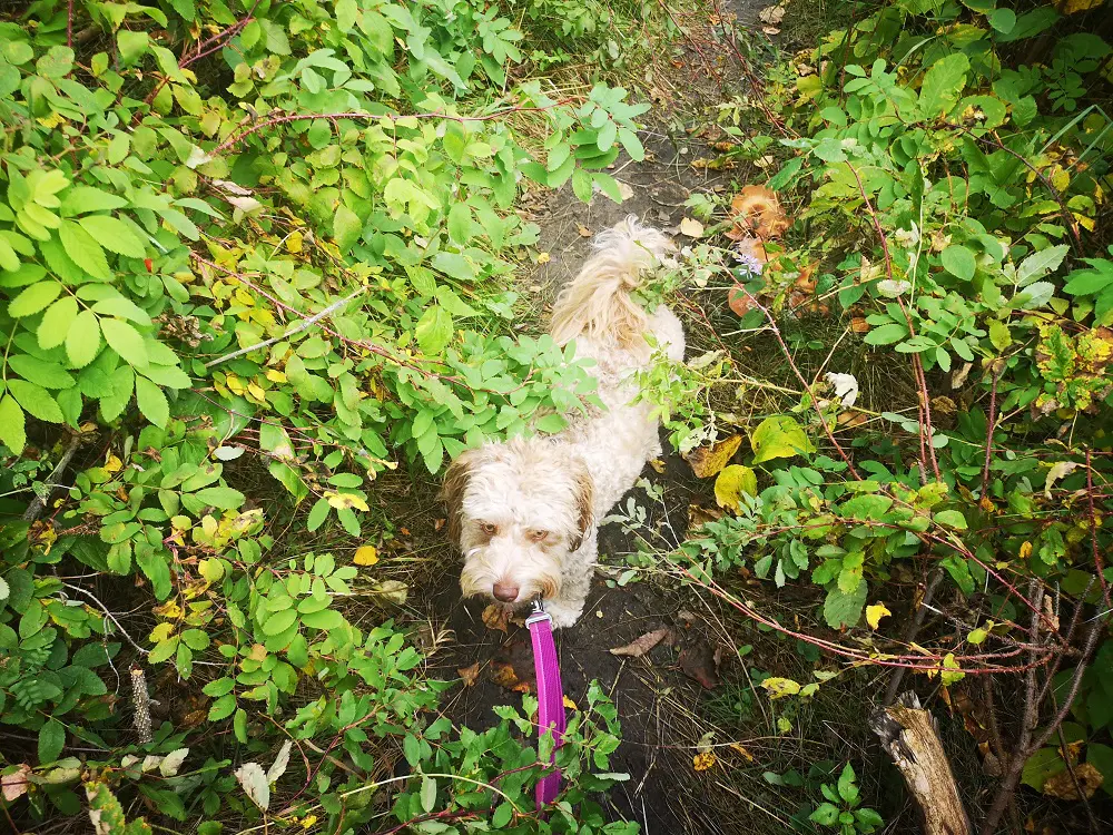
Be prepared to navigate some overgrown trails and do some bushwhacking! If you’re little like Miski, you can just walk underneath it 😉
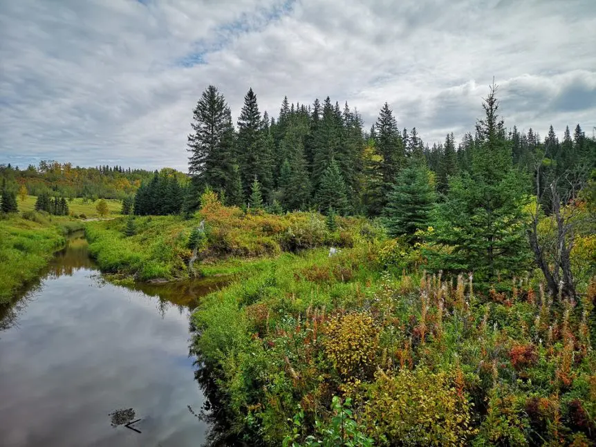
Challenges aside, this walk is especially beautiful in autumn as the leaves and larch trees change colour! It’s a tranquil nature escape as well; despite being in the city and near major roads, you can barely hear the sounds of traffic and city life. Instead, notice the wind whistling through the trees, the babbling of Whitemud Creek, the slight ripples of Oxbow Lake and the chipping of white-throated sparrows. The area is also great for bird watching and wildlife sightings. EALT has put together a self-guided tour pamphlet that you can reference on your walk to learn more about what you’re seeing.
Given a lack of signage on the trail, it’s easy to walk off the main trail and head upwards into a suburb or otherwise off the loop. We recommend following your steps with the AllTrails app and map of the trail to check the GPS and make sure you’re on track, especially if you’ve come to a fork in the trail and aren’t sure where to go.
Directions:
Parking:
- Signage is not obvious for parking at Larch Sanctuary. You can park on either side of the 23 ave bridge (between Rabbit Hill Road and 119 St), which goes over Whitemud Creek. See parking map below.
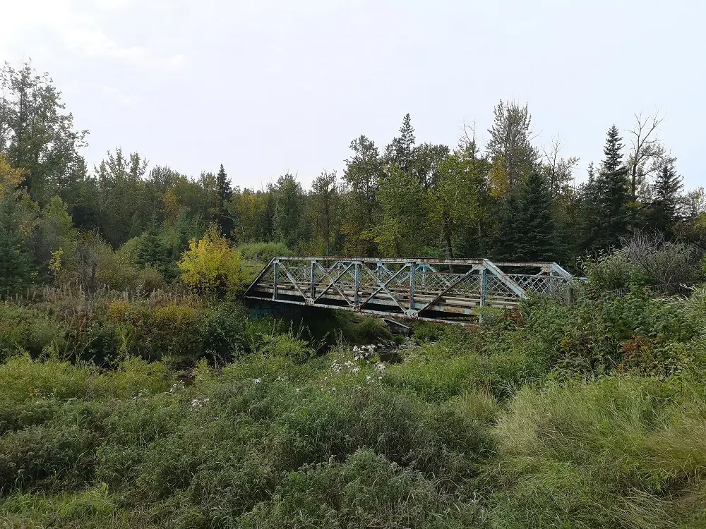
This bridge signals the start of the hike.
Route:
1. From the parking lot, head towards the beginning of the trail, which is right before a beautiful bridge. Just across this bridge is a sign welcoming you to MacTaggart Sanctuary (the other official name of this area).
2. From the welcome sign, generally bear right along the trail. The trail is a loop, so you will be returning back to this spot without having to turn around part way through the trail.
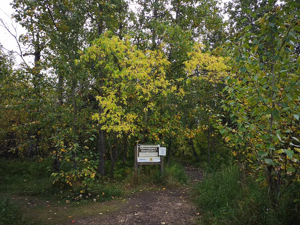
First and only sign you’ll see on this walk.
3. The first real fork is when you approach a small hill with exposed tree roots. Head right; you will return back on the left side.
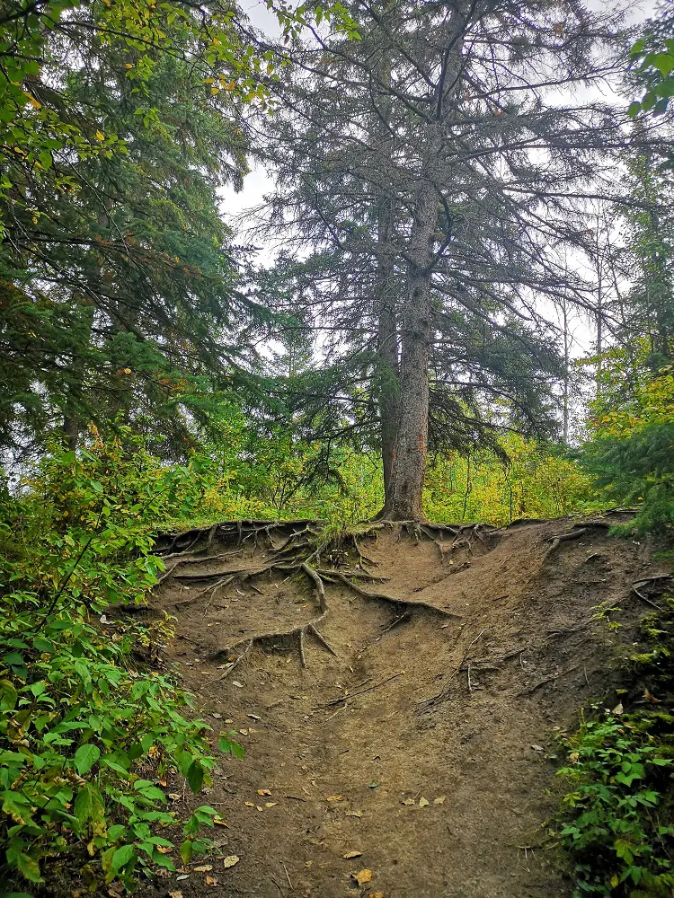
Be prepared for steep and rooted terrain like this!
4. As you continue, you can head down the path to get a closer look at the lake – watch out for wildlife! In addition to water insects, you may see some ducks feeding along the water or a moose or deer walking across it!
5. The trail makes some steep inclines and declines – watch your footing as there can be mud and exposed tree roots that make for tripping hazards.
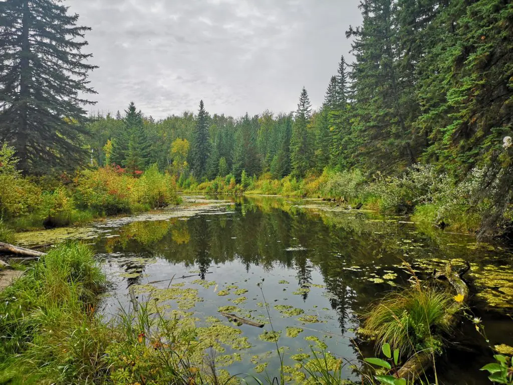
First views of the Oxbow Lake
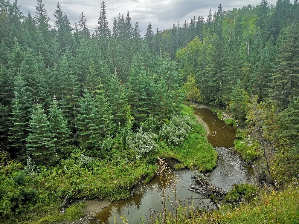
6. Halfway through the walk you will come across Oxbow Lake. This lake is unique as it’s Edmonton’s only oxbow-shaped lake, though it was once just part of Whitemud Creek.
7. As you ascend up from your first views of Oxbow Lake, you’ll come across a hill made of bentonite clay. It’s quite steep and a bit of a scramble to ascend, so tread carefully, especially if it’s wet or muddy.
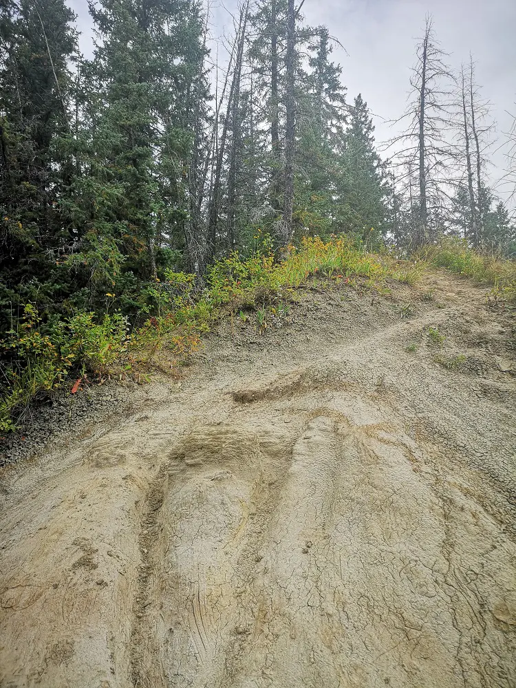
Steep bentonite clay slope – bentonite absorbs more water than dirt so can be especially slippery under wet conditions.
8. You’ll come back down the other side, mostly descending. There are opportunities to get closer looks at the creek and the lake if you care to explore around the shore!
9. You’ll return to that first steep hill and the bridge after about an hour of walking, longer if you chose to meander and take in the views and sounds.
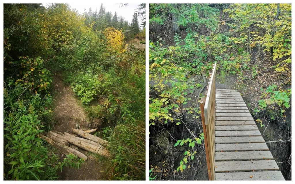
You’ll come across some adventurous trail crossings due to erosion.
10. You’ll end up back at the bridge and the parking lot – don’t forget to spot the bee hotel near the entrance that’s keeping lots of baby bees safe and happy!
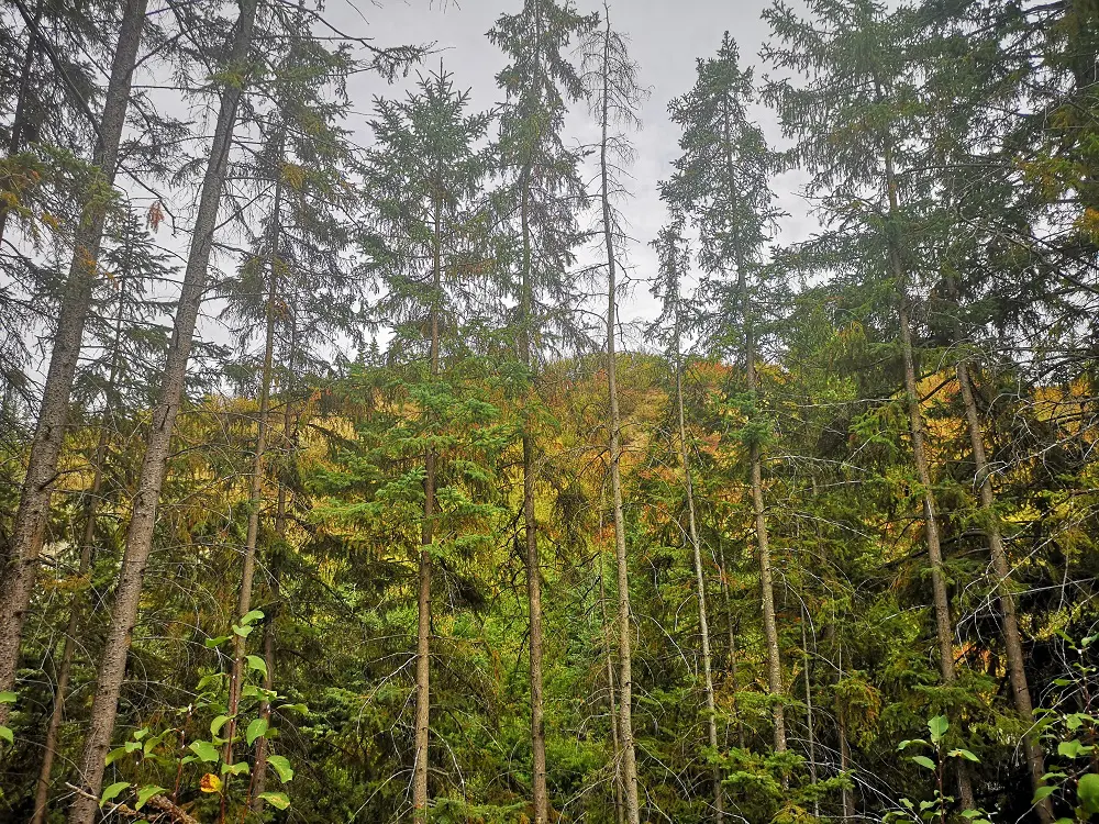
No shortage of beautiful autumn colours on this hike.