
Length: ~6 km loop, 1-1.5 hours.
Trail condition: Wide paved and flat path. Option to take single track trails for a portion of the loop that are closer to the river.
Difficulty: Easy
Bikes: Allowed
Dogs: Allowed on-leash.
Parking: See maps and instructions.
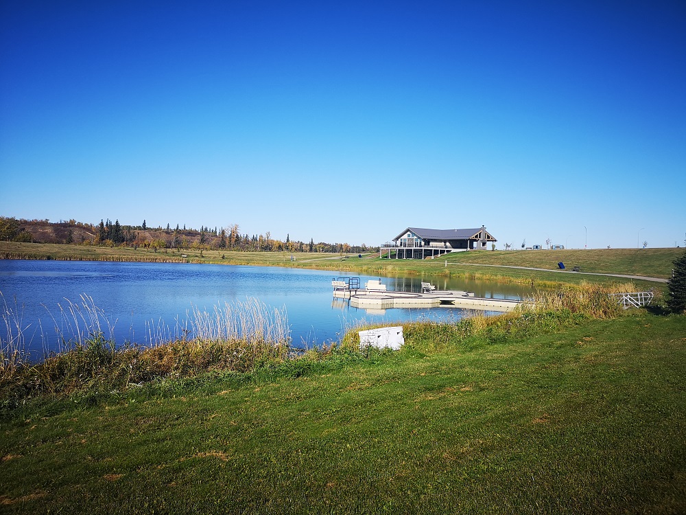
West River’s Edge pavilion and Lion’s Fish Pond.
If you’re looking to do some river valley exploring outside of Edmonton, give this trail in the northeast a try! West Rivers Edge in Fort Saskatchewan is a recreation pavilion that can be rented out for events and is also attached to the stocked Lion’s Fish Pond, and this trail loops from the pavilion parking lot and back along the riverside and around the large fenced dog park. The wide paved trail makes for an easy ride or stroller walk while affording great views of the river at the well-situated viewing decks along the trail. Or, if you’re a mountain bike enthusiast, single track trails and obstacles are available to explore.
Red Coat Landing boat launch
Directions:
Parking:
- Both West River’s Edge and Red Coat Landing have a parking lot with lots of room. Make sure you don’t park in a boat launch spot.
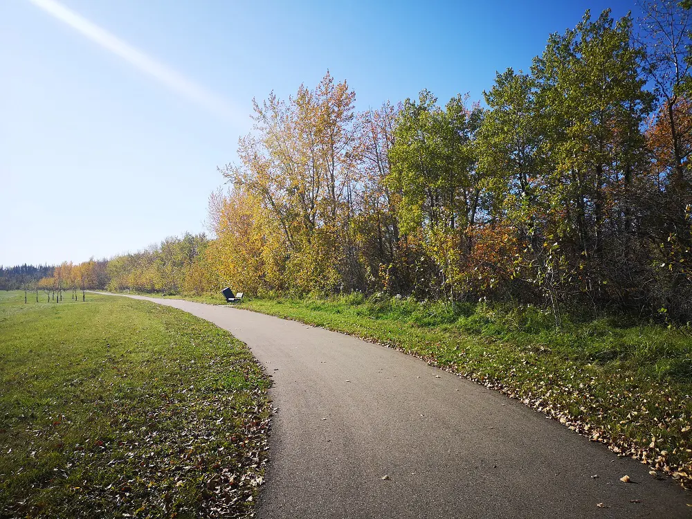
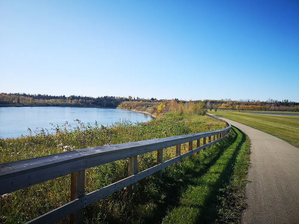
The trail is wide, flat and paved.
Route:
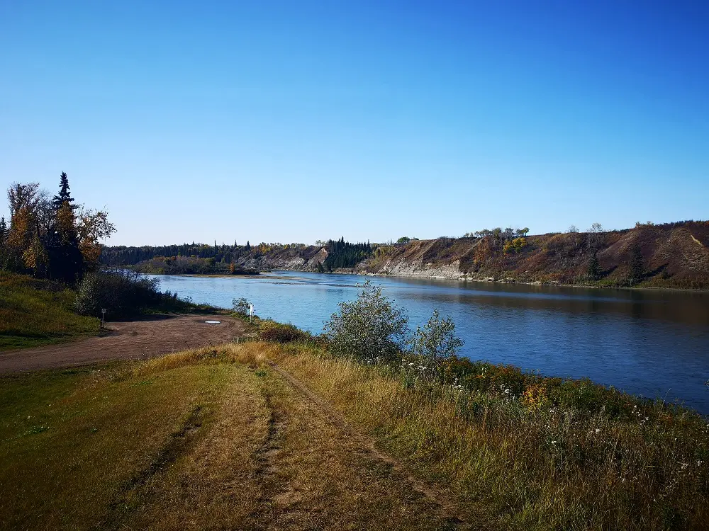
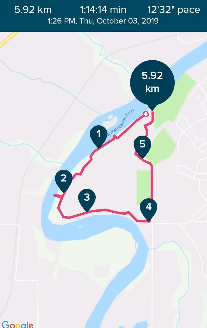
1. From the parking lot, take your first big view of the Fort Saskatchewan river valley from the Red Coat Landing boat launch. There is a viewing deck so you don’t have to go down to the water’s edge for a good view.
2. From Red Coat Landing, head back to the parking lot and follow the trail that heads south-west from there. Throughout the trail, there are several wayfinding signs that help you stay on the West River’s Edge Loop so it should be near impossible to get lost.
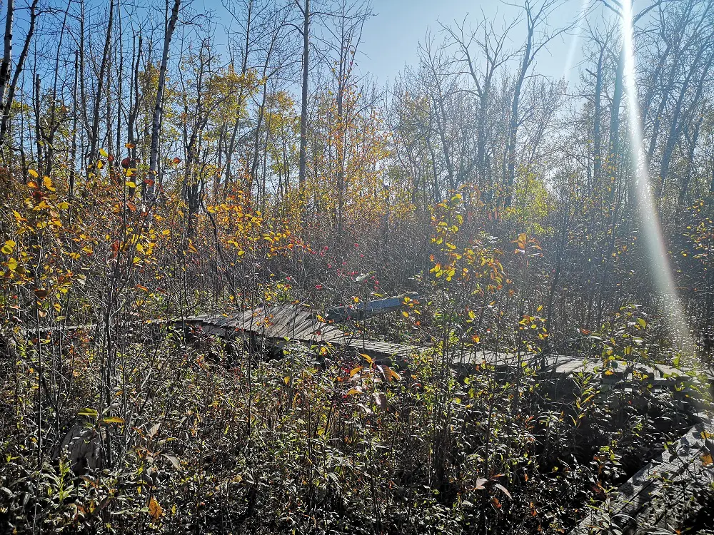
There are obvious sections where you can go on a path into the trees and check out the single track obstacles.
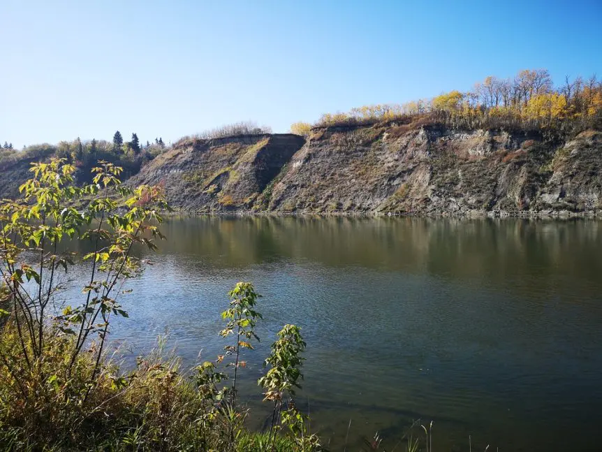
3. Along the trail there are several viewing decks that allow for closer views of the river, since for the majority of the trail the river is hidden through the trees. Make sure you take advantage of these spots and snap some pictures! (And share them to social media with the hashtag #trekthetrails!)
4. After 2 km, you’ll encounter a sign that points you to the river or to the dog park. (You can also enter the dog park when you reach the road after 4 km of walking if you wish). Take the little detour down to the river before coming back to join the main trail.
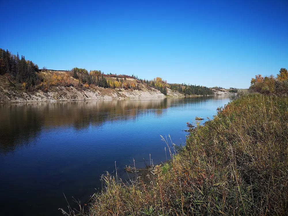
River views
5. The trail snakes around the river’s bend, and the trees open up a bit so you can catch views of how the river twists. Eventually the trail reconnects with a dirt road just before you reach 4 km. Cross the road and continue to follow the wayfinding signs for West River’s Edge loop. You’ll be walking parallel to the DOW Fields and a playground before turning north and joining back up with the West River’s Edge Fish pond.
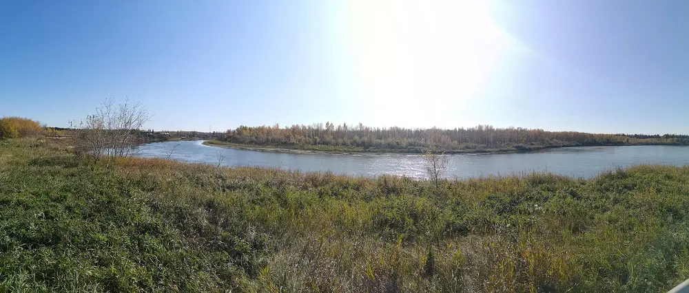
Just around the riverbend…
6. Once at the pond, you can either reconnect with the trail you started on or loop around the pond to join up with the West River’s Edge pavilion and parking lot.
The trail opens up to see the river around km 3.