
Length: ~ 5 km round trip, 1 to 1.5 hours
Trail conditions: Moderately flat aside from two sets of staircases, paved and dirt path
Difficulty: Moderate
Bikes: Allowed
Dogs: Allowed off-leash on dirt trail, on-leash on stairs and other areas
Parking: Street parking at Concordia University or upper level of Highlands Golf Course

This trail is mostly a dirt path surrounded by shady trees.
With a gorgeous set of wooden stairs at either end of this hike, this beautiful riverside walk along the river and beneath the Highlands Golf Course is a great way to connect with nature and take your dog on a quiet, off-leash walk. This route can be done as an in-and-out/there-and-back trail beginning at Concordia University or 50th Street, or you can make it a loop by walking along Ada Boulevard at the top of the river bank on the way back, admiring the views and the historic houses. Or, you can turn this into a longer adventure by adding to the east to Rundle Park or west to Dawson/Kinnaird Park.
The trail winds up and down along the river
DIRECTIONS:
PARKING
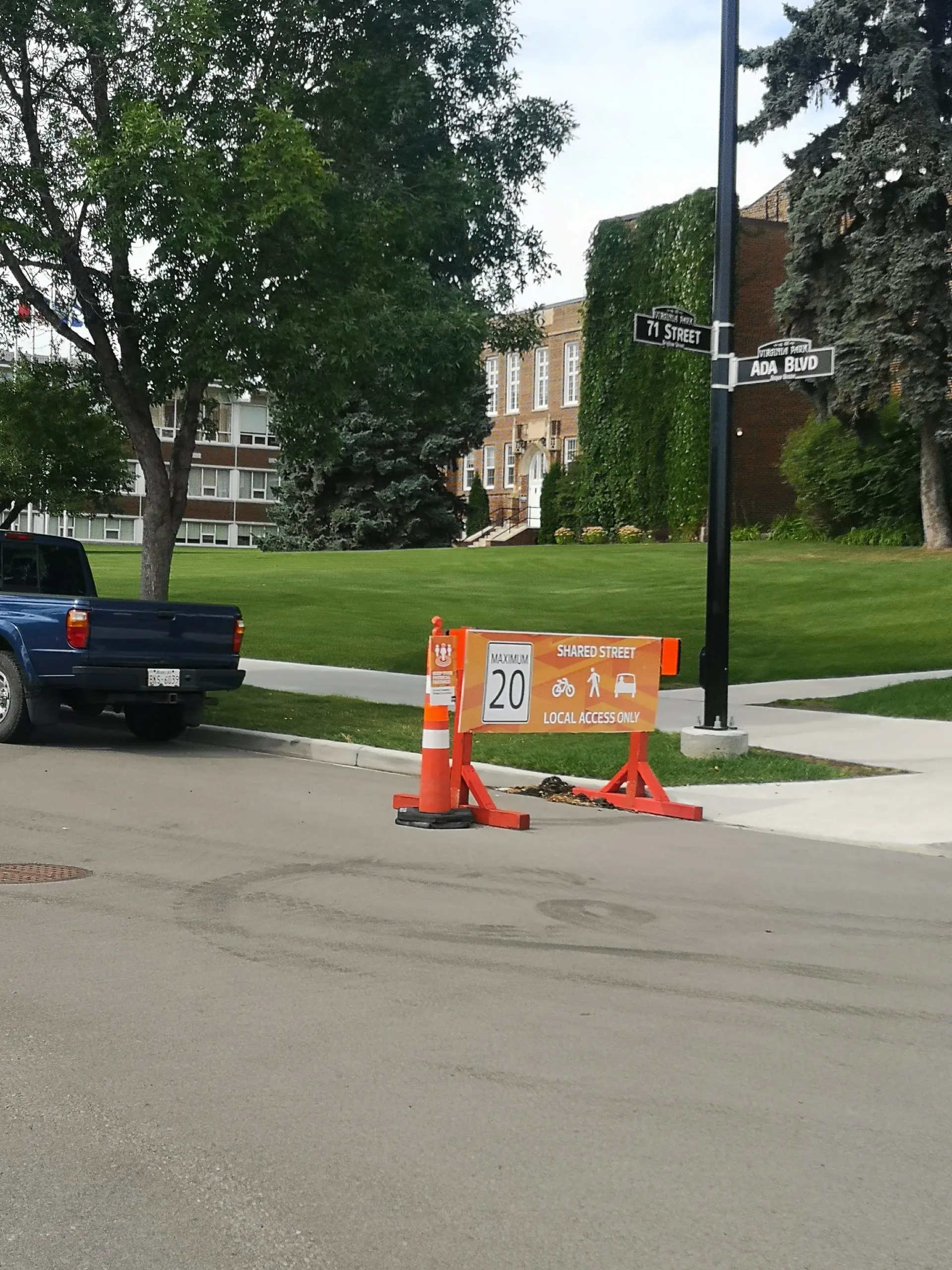
There is street parking near Concordia University, or park along Ada Boulevard (respect parking limitations and restrictions). Due to COVID-19, Ada Boulevard is classified as a “shared street” with speed limited to 20 km/hr.
ROUTE
Street parking is available along Ada Boulevard near Concordia University.
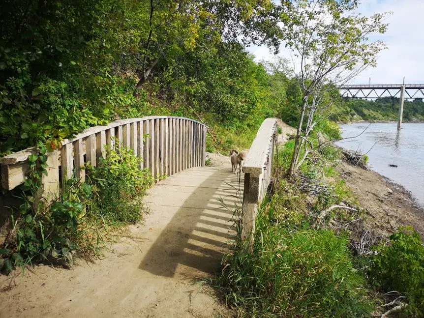
1. From your parking space near Concordia University, head towards 71 St. You’ll see a set of wooden stairs leading down to the river valley. Take the stairs down, and at the fork, go left/east towards the next set of stairs.
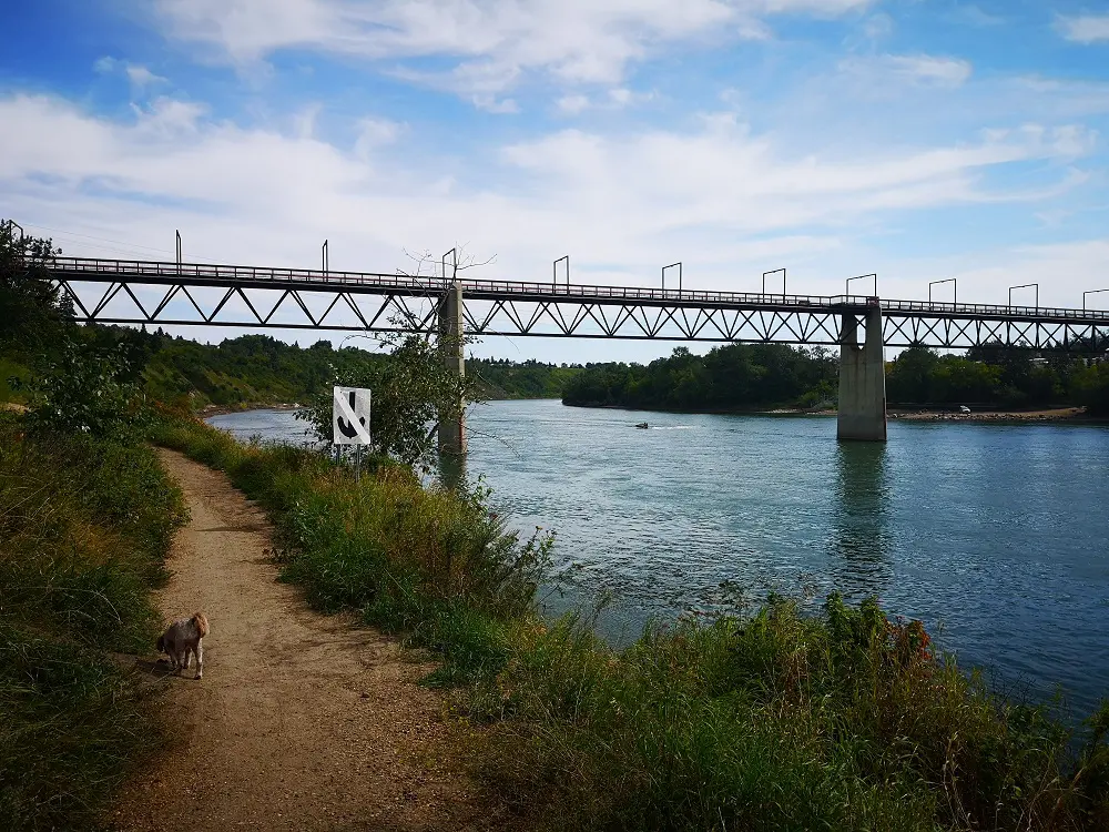
2. Follow the trail headed east towards Capilano Bridge. The trail continues along the bridge before connecting with a golf cart trail as part of Highlands Golf Course.
3. Cross the golf cart trail past a fence underneath the bridge (the gate will close and indicate trail closure if the river level is too high), and turn left.
Trees opening up to river views
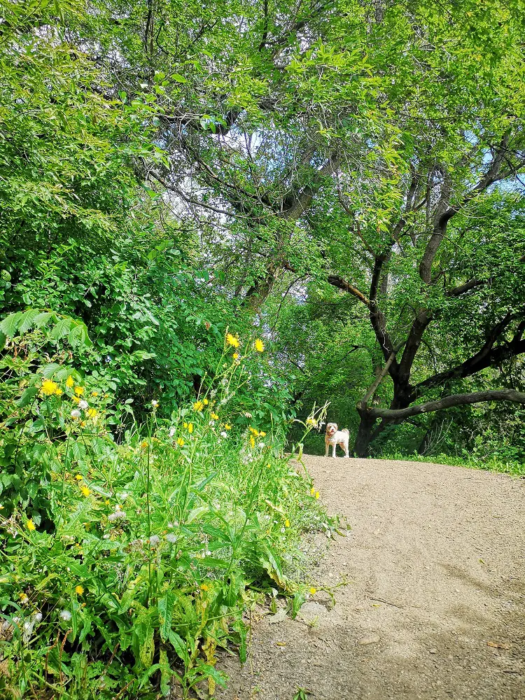
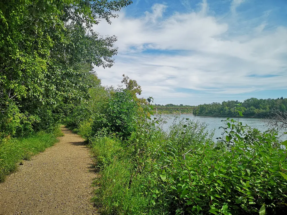
4. Follow this dirt trail (an off-leash area) for roughly 2 km. It offers scenic viewpoints of the river and skyline every few steps through the trees.

Shady bench to stop and enjoy nature.
5. The views showcase the Ainsworth Dyer footbridge, which connects Gold Bar Park and Rundle Park. You’ll even cross a cute mini footbridge that goes over an outflow.
Ainsworth Dyer footbridge
6. Before the Ainsworth Dyer footbridge, you’ll reach another set of wooden stairs that climb you back to Ada Boulevard. You can climb these stairs for the views and then turn back the way you came or walk along Ada Boulevard to return to your car.
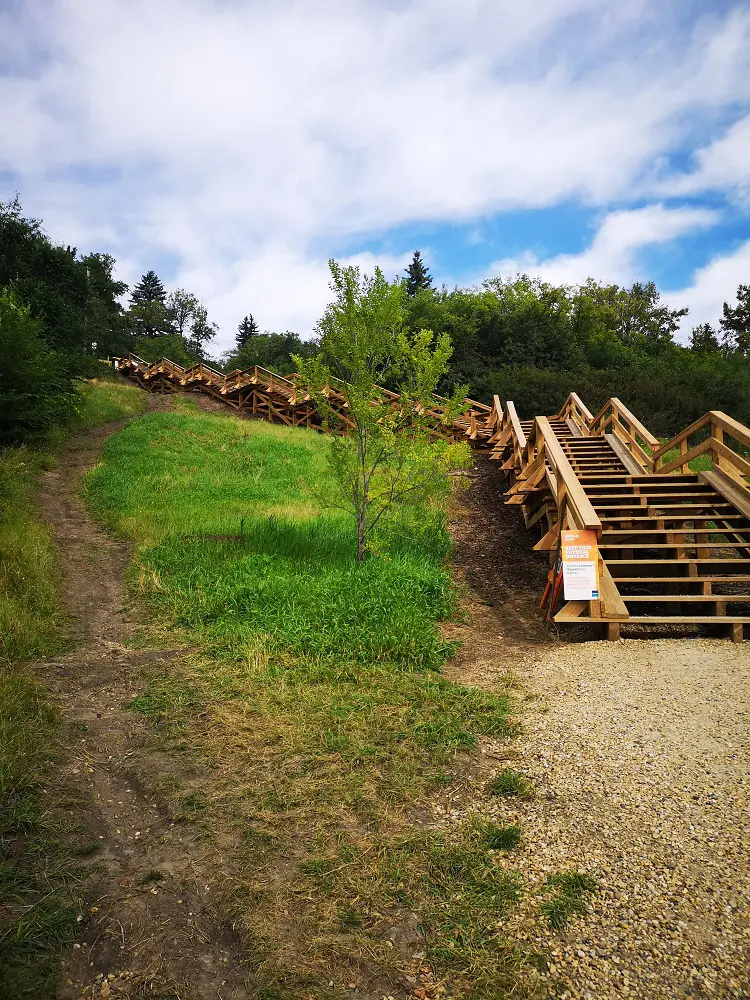
The 50th St Stairs
7. Walking back along Ada Boulevard, you’ll see historic homes like the Magrath Mansion and higher views of the opposite bank of the North Saskatchewan River.
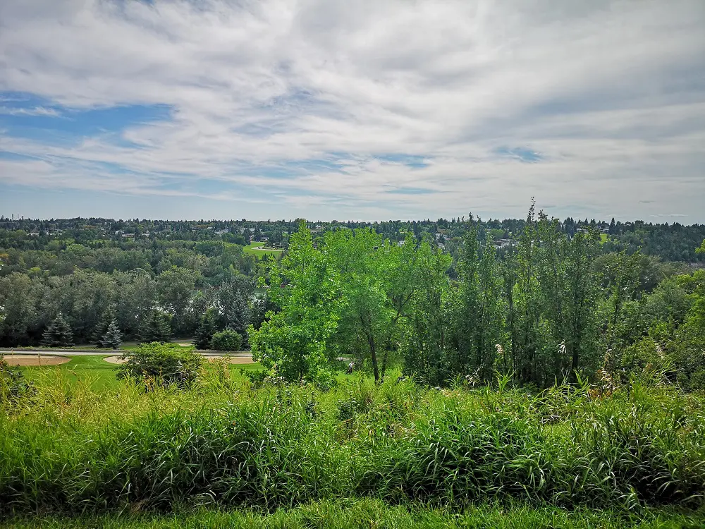
Views from Ada Boulevard
MAPS