
Length: 5 km round trip, 1 – 1.5 hours
Trail conditions: Moderately flat with some inclines (slippery in snow). Paved path and dirt path (snow-covered in winter.)
Difficulty: Moderate
Bikes: Allowed
Dogs: Allowed off-leash except where indicated
Parking: Mill Creek Outdoor Pool and Overflow Lot
Mill Creek Ravine South is a great place to take your pup off-leash.
We’ve already written about a short trail route in the north section of Mill Creek Ravine. In this Trail Trek how-to blog, we’re profiling a longer, predominantly off-leash route and a perfect way to burn off your pup’s energy in the winter months.
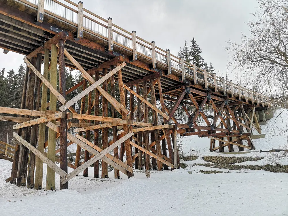
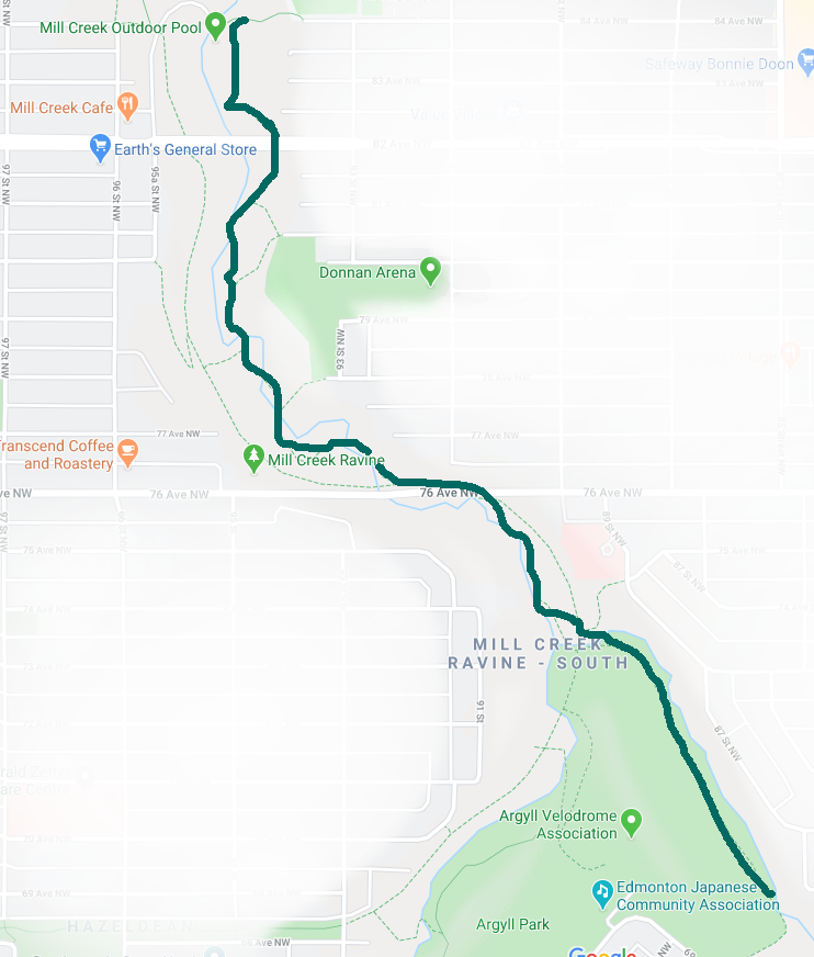
As Mill Creek stretches from Gallagher Park to Mill Woods, there are several different routes and access points for trekking the trails; this route features one of many possibilities. In addition to Mill Creek’s signature red bridges, you’ll see a couple of tall trestle bridges that you won’t see in many other places in Edmonton. This there-and-back trail begins at Mill Creek Outdoor Pool and ends at Argyll Park, where you turn around and return the way you came.
The trail is scenic in winter and summer.
DIRECTIONS:
PARKING
You can follow Google Maps directions to Mill Creek outdoor pool for this route. There’s a small public lot at the base of the ravine, but if this is full, there is a massive overflow lot before you enter the ravine.
ROUTE
1. From the outdoor pool parking lot, head east and up the hill. Turn right when you see the sign indicating you’re entering an off-leash area, and follow that trail heading generally south.
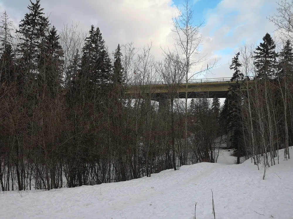
First, towards the overhead bridge, where Whyte Avenue crosses over the ravine.
2. The path continues towards the Whyte Avenue bridge. After you walk under the bridge, there are a couple of places where you branch off but end back on the same trail—so as long as you generally stay on the lower trail, you’ll be headed in the right direction. Trails that verge steeply up towards the east will take you to the neighbourhood and off the ravine trail.
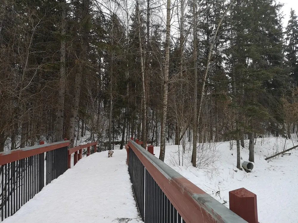
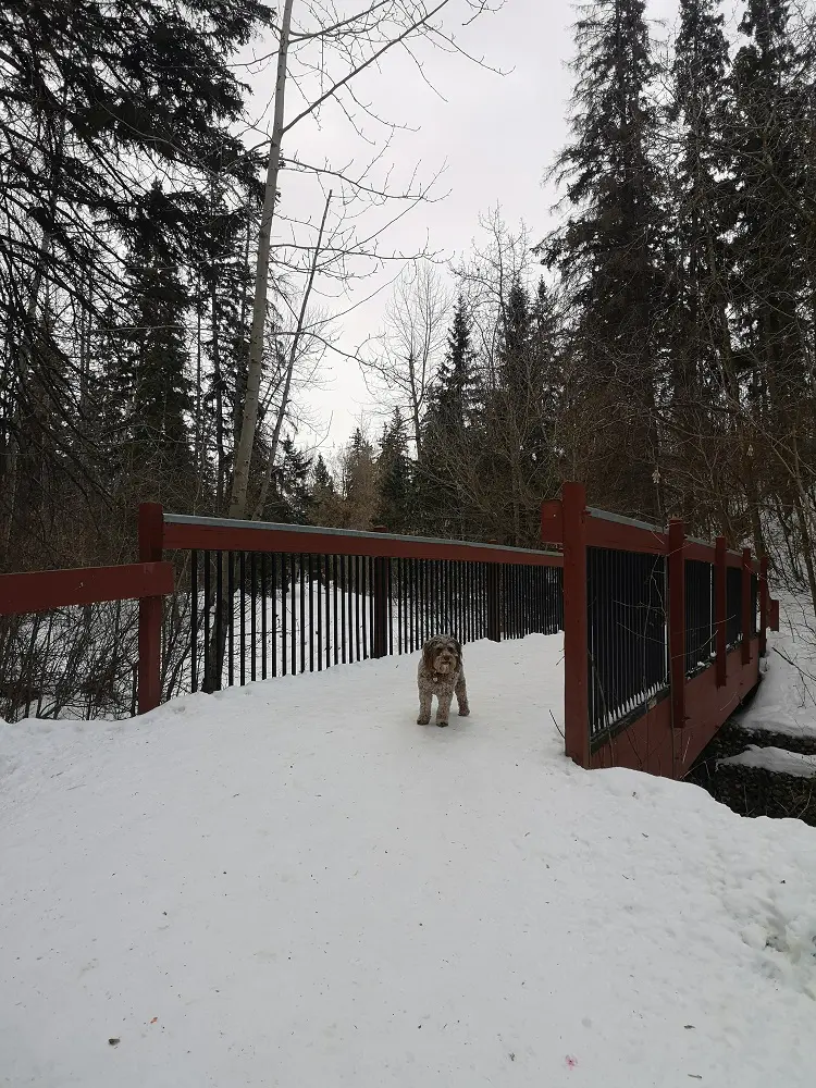
One of the ravine’s many red bridges.
3. You’ll cross a few of the ravine’s iconic red bridges before reaching a sign indicating you are leaving the off-leash area. Leash your pup if you’re with one, and head upwards towards 76 Ave.
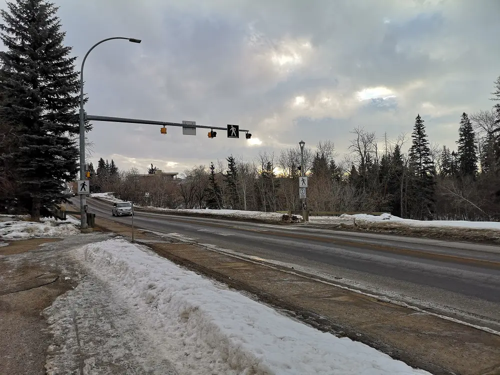
Cross at the crosswalk at 76 Ave (this area is not off-leash!) before heading south into the ravine.
4. Cross at the crosswalk on 76 Ave and take the lower path back down the ravine. The off-leash area resumes once you’re in the ravine.
You can go under the bridge and veer right, towards another red bridge and not up the staircase.
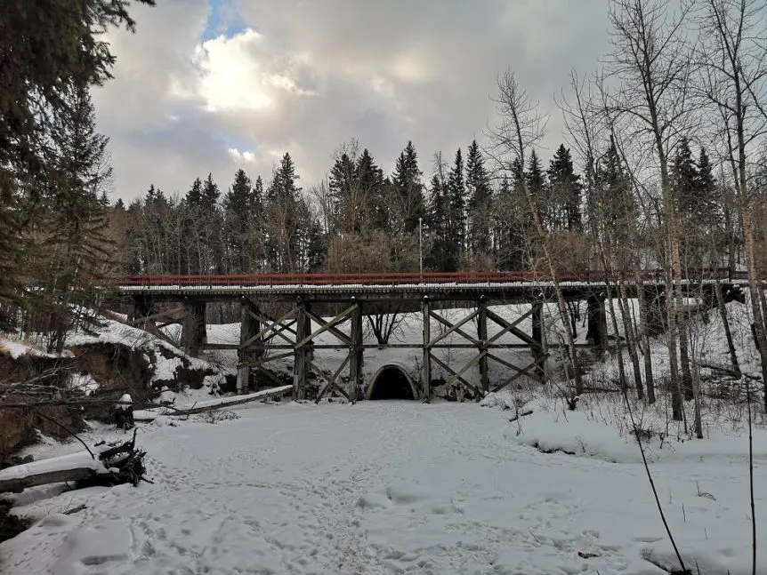
5. After 400 metres, you will reach a tall trestle bridge and a crossroads. Head left. You will see a staircase and a path leading to another red bridge. Walk to the bridge and continue on the trail.

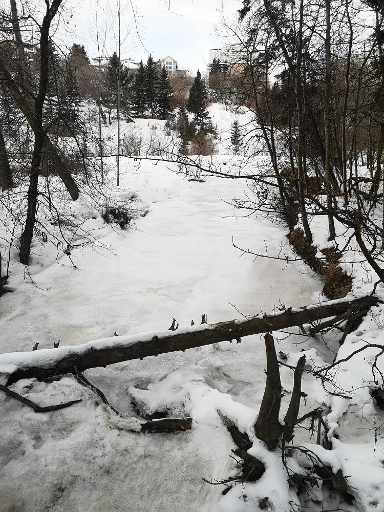
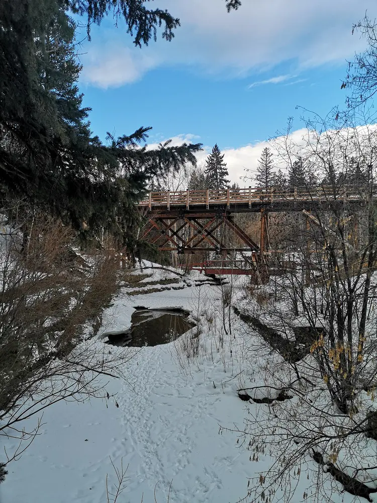
This section of the trail is the most scenic.
6. Continue walking through the ravine for another 750 m. At this point, you are circling Argyll Park. Eventually, the trail starts coming out of the park and into a neighbourhood, and a sign indicates you are leaving the off-leash area. This is where we turned around to keep the route length around 5 km round trip.
Heading back to the beginning.
7. Turn around and go back the same way you came. Once you cross 76 Ave again, there is an option to take a different trail, which is the “high route,” but at the time of testing out this route, there was construction on this trail near the Whyte Avenue bridge, so you would have to detour. To avoid unnecessary detours, go back the same way and relive the beauty of the lower ravine, the red bridges and the escape from the city.