
Length: ~ 6 km round trip, 1 hour to 90 minutes
Trail conditions: Moderately flat with some inclines, gravel path and dirt path (snow-covered in winter)
Difficulty: Easy
Bikes: Not allowed
Dogs: Allowed on-leash
Parking: Parking lot at Alfred H. Savage Centre
Whitemud Ravine is a nature reserve in the heart of the city.
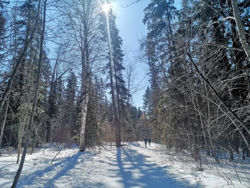
Whitemud Ravine is a nature reserve in the city’s heart, complete with old-growth forest, over 150 species of birds and several species of wildlife. Despite its proximity to the busy freeway Whitemud Drive, it is easy to distance yourself from the bustle of the city, bird watching, and it’s a great pl, of course, #trekthetrails. On our March test walk of this route, we saw a Great Horned Owl, chipmunks, squirrels, chickadees, and a woodpecker, with the sounds of birdsong guiding us through the 6 km in-and-out trail. The ravine also stretches further south from this route so that you can stretch this trail out even longer. We wrote about a section of the Whitemud Ravine system (and another nature reserve), Larch Sanctuary, on a previous trail-trek blog.
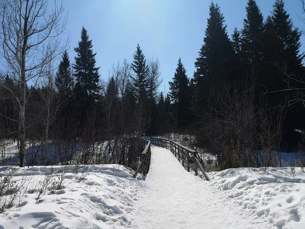
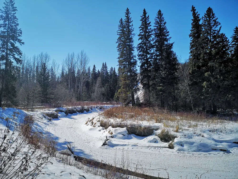
The trail features several boardwalks and bridges to help navigate over the winding creek.
DIRECTIONS:
PARKING
Depending on where you want to begin this in-and-out route, you can park at Alfred H. Savage Centre or Rainbow Valley Campground. This blog begins at the Savage Centre.
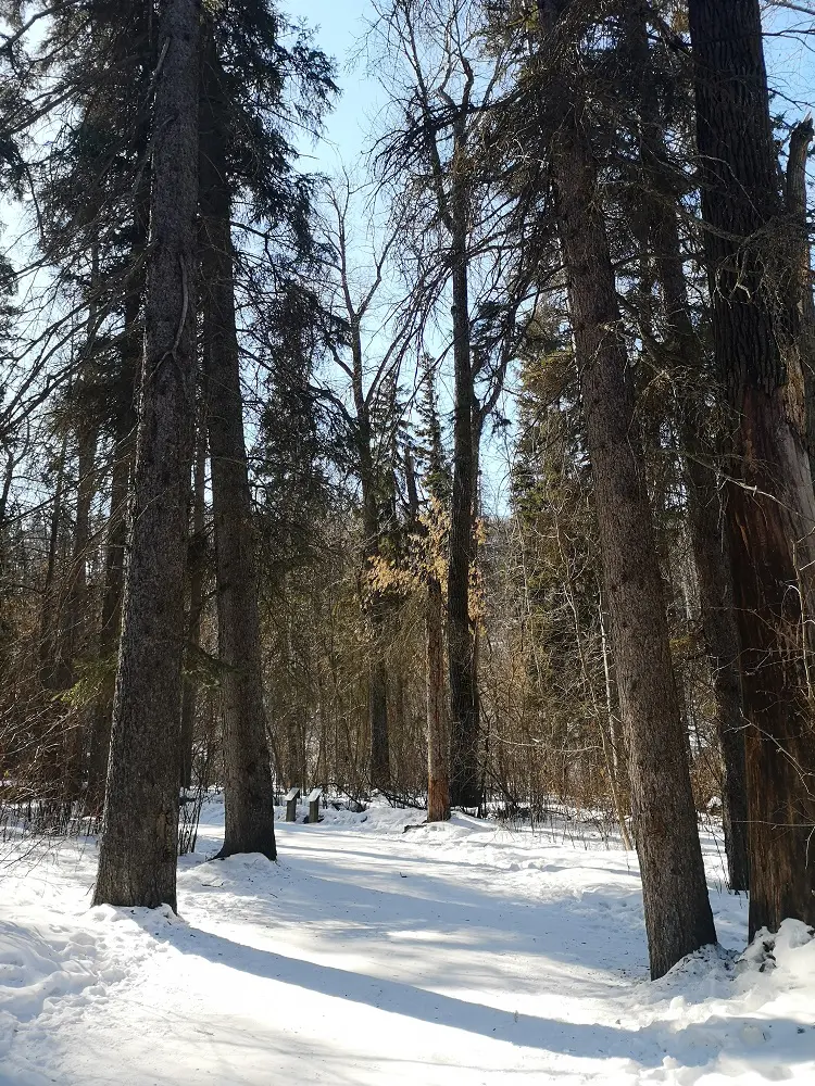
Whitemud Ravine is home to an old-growth forest with some of the tallest trees in the city.
ROUTE
1. After parking at the Savage Centre, head south from the parking lot towards the first bridge that crosses Whitemud Creek.

After crossing the first bridge from the parking lot, head left to continue into Whitemud Ravine.
2. From the bridge, you’ll reach a T intersection. To the right goes under Fox Drive to Fort Edmonton Park and the North Saskatchewan River (where you can also park), a short little detour if you desire (or you can save for the end). To the left is the trail through Whitemud Ravine. Go left. The trail will curve around the Whitemud Equine Centre (where you’ll experience a short stink of horse manure) before heading into the ravine.
3. From here, following the trail is pretty straightforward. A few turn-offs take you into the surrounding neighbourhood (e.g., Grandview, Brookside), which you can ignore.
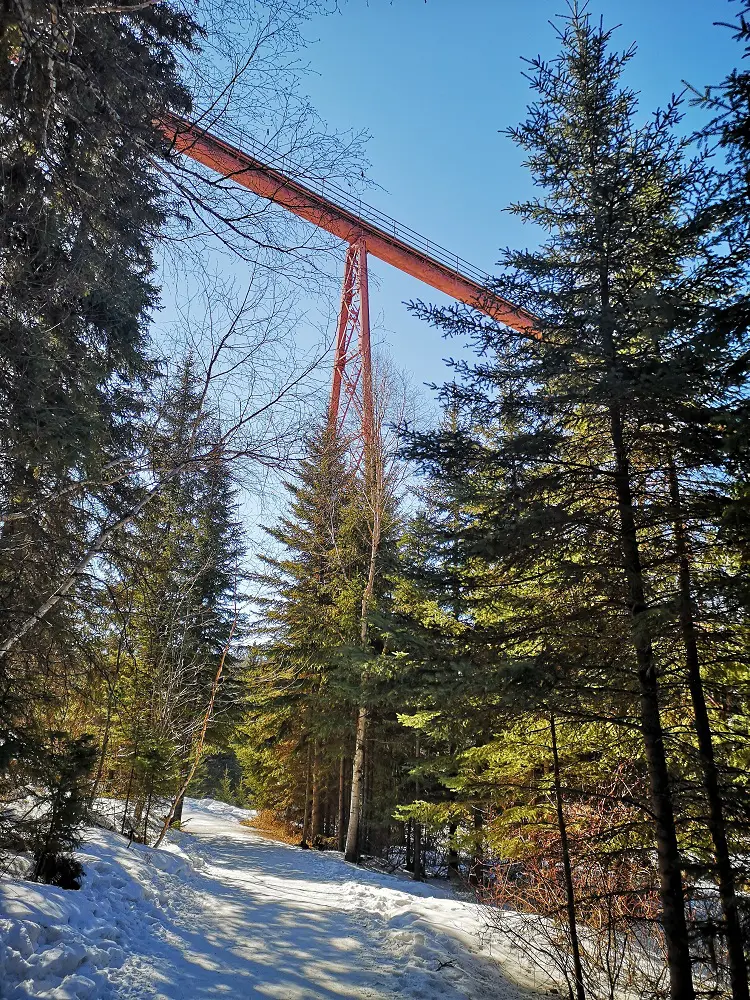
The water pipe bridge is a landmark in the Whitemud Ravine.
4. Continue following signs for Snow Valley and Rainbow Valley Campground as the trail weaves around Whitemud Creek, crosses little footbridges, and crosses under a super tall water pipe bridge.
5. Along the trail, there is a lot of interpretive signage for the types of trees present in this old-growth forest and signs detailing information about the area’s bird species and wildlife, like squirrels, chipmunks, muskrats and beavers. Many bird watchers frequent the area, so if you see one of them looking up, chances are they’ve found a unique bird to look at!
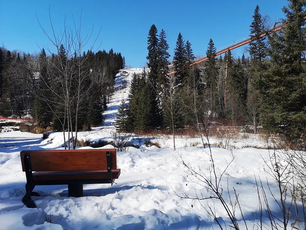
Rest and enjoy the views.
6. After ~3 km, you will cross a small bridge and reach the facilities parking area for Snow Valley and Rainbow Valley Campground. At this point, you could continue south to explore Whitemud Ravine more or turn around to go back the way you came.
7. It’s also straightforward to do this trail in reverse, beginning at Snow Valley and turning back at the Savage Centre or Fort Edmonton.
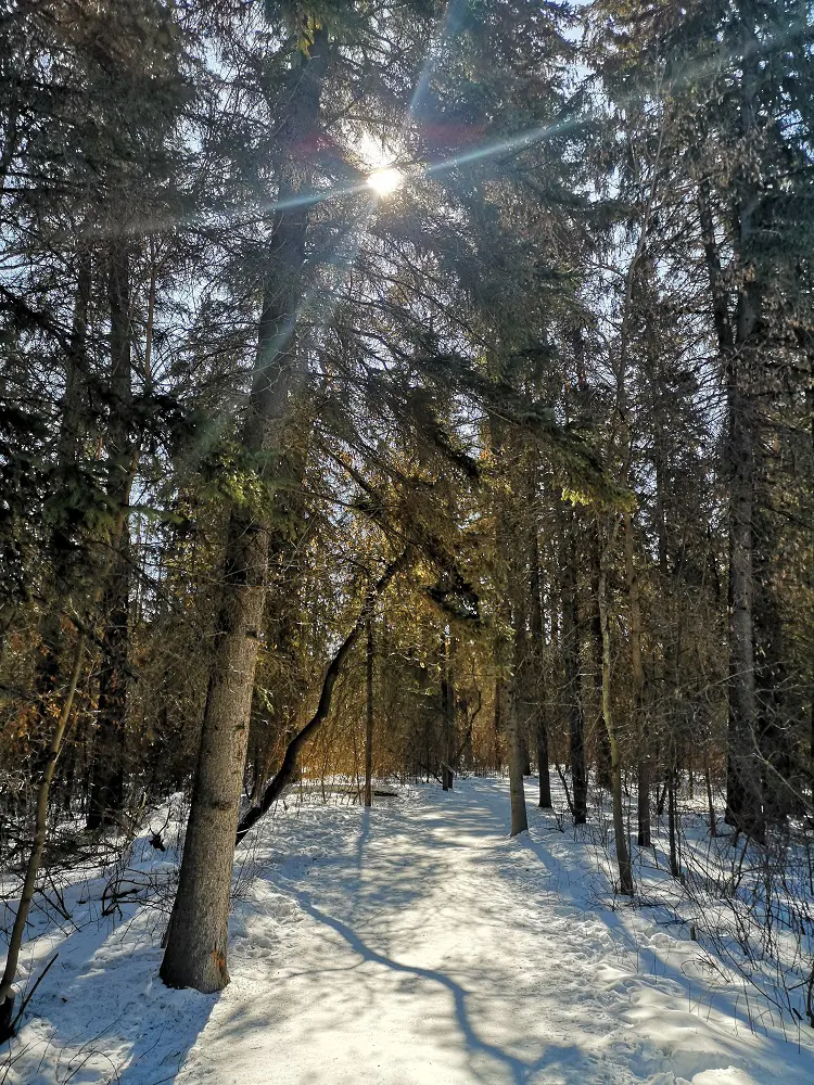
You won’t even feel like you’re walking among these tall trees in the city.
MAPS
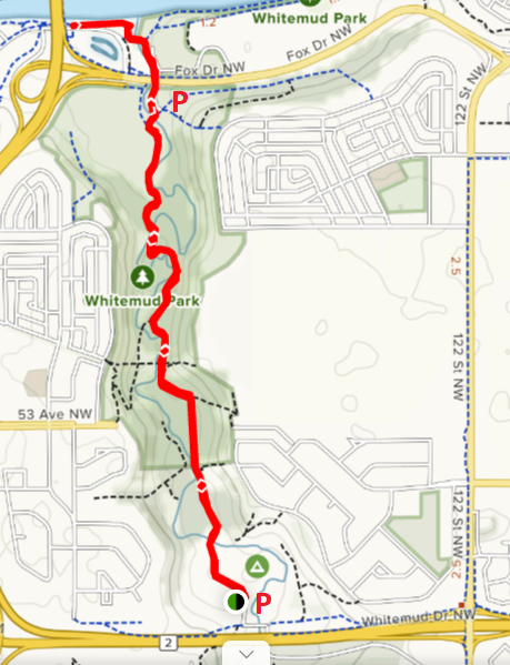
Trail Map (image source: AllTrails)