

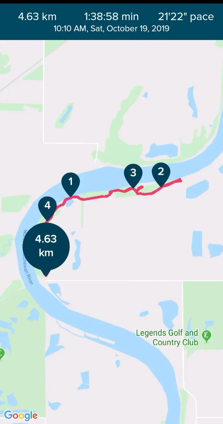
Length: ~5 km, 1-1.5 hours.
Trail condition: Gravel and dirt trails, moderately flat with slight inclines
Difficulty: Easy-Moderate
Bikes: Allowed
Dogs: Allowed on-leash.
Notes: There are no outhouses or bathrooms on the trail or trailhead. There is one garbage can at the trailhead.
Parking: See maps and instructions.
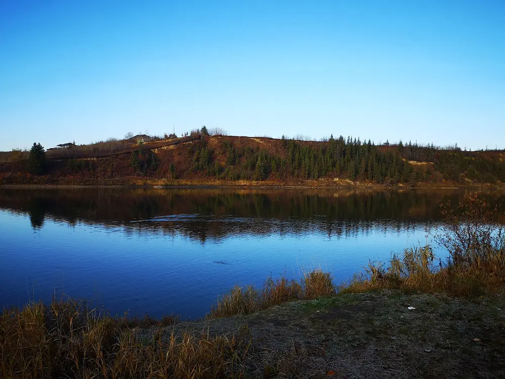
Across the river from Riverside Nature Trail is the East End Trails and Quarry Ridge lookout point.
Riverside Nature Trail in Strathcona County is a hidden gem of a trail that you can do as either a 5 km in-and-out route, a 5 km loop, or walk 11 km all the way to Fort Saskatchewan and West River’s Edge. Eventually (we hope!), this trail will connect to Edmonton via a pedestrian footbridge over to the East End Trails, which are visible across the river from this trailhead.
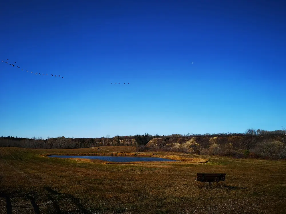
Birds flying south as the weather cools.
There is signage along the trail showing you how to do the trail as a loop, which has the trail leave the riverside after 2.7 km to walk alongside a field and then back beside the road to the beginning. We prefer to do the trail as an in-and-out, turning around at 2.7 km (marked with a sign and a trail fork) so we stay in the trees and close to the river for the whole way. The distance is almost the same whether you complete the trail as a loop or an in-and-out, so it’s all about your preference and whether you want to walk the same way twice!
The trail is a mix of gravel and dirt.
Directions:
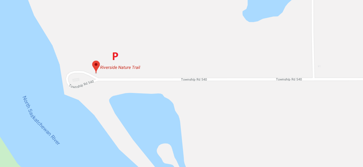
Parking:
- To get to the trailhead, follow Township Road 540 all the way west to its termination. You can access Township Road 540 from Sherwood Drive/Range Road 232. Riverside Nature Trail also has an accurate entry in Google Maps.
- The trailhead (see map) has a small parking lot.
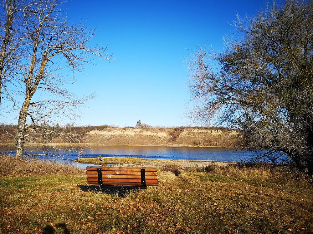
First bench vista of the trail.
Route:
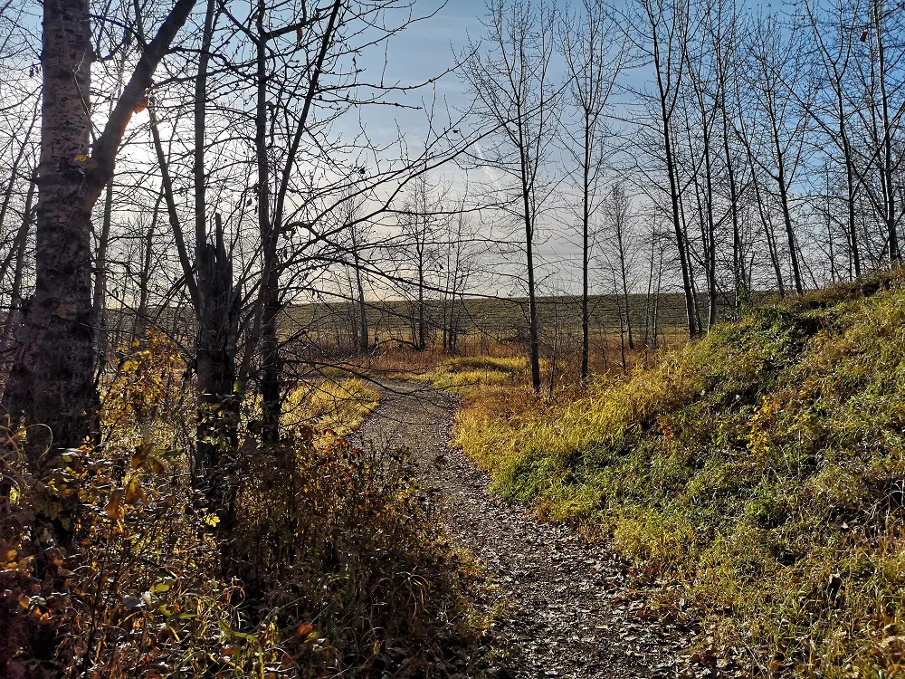
1. From the parking lot, follow the wide dirt trail as it weaves between rows of trees. It’s fortunately fairly difficult to get lost on this trail so you can generally just follow the tracks and be good to go.
2. After 500 m, the trail opens up to a hilly field and a pond. The trail continues here along well-trodden grass. Don’t forget to stop at the first viewpoint of the river, complete with a bench!
3.The trail heads back into the trees after you cross the field and continues to follow along the curves of the river.
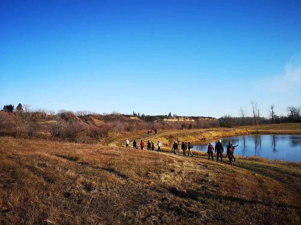
Walking through the field and by the pond.
4. Just before the 2 km mark, there’s an unofficial path that diverts off the main trail—offshooting here will lead you to a great vista, as well as a man-made tower for osprey nesting!
5. Come out of the offshoot and continue for roughly 600 m. At this point you will come to another bench and viewpoint, as well as a fork in the trail. Going right at the fork will take you on the Riverside Nature trail loop. Turning around and going back the way you came is what we recommend for the best views and experience. Or, if you’re feeling adventurous and have time to kill, follow the trail another 7 km to Fort Saskatchewan!
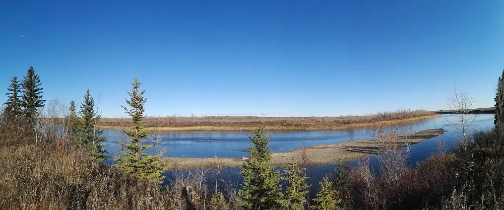
Panoramic views at the turnaround point.